

|
by Joseph Brennan. Copyright 2001, 2002. |
City HallPassenger service: October 1904 - December 1945.Existing abandoned portions: 1 platform (on a track in service). Touring: 4 5 6 trains to Brooklyn Bridge. From the south end of the downtown platform, watch the 6 train turn sharply right into the loop as it leaves empty, and it will reappear on the far side a minute later, having gone round the loop. There is officially no way to view the station, although it would be easily seen from the 6 train in the loop. The three station skylights corresponded to three gratings in City Hall Park, but they have been covered over in the past few years; a solid hatch door appears to mark one of them. construction and operationCity Hall was the ceremonial terminal of the first subway project in New York, the place where the mayor could show off the subway built with the people's money to benefit the greatest city in the country. Not at all characteristic of the first subway, it has a sharply curved platform, a Guastavino tile arched ceiling, skylights (blackened in World War II), and plaques praising the work and those involved. The official start of construction took place on 24 March 1900 at the front steps of City Hall, on the site of the station. Unfortunately, for all that, it was never an important station. It was located on the turning loop for local trains from uptown, and both those and the express trains could be easily taken at the very nearby Brooklyn Bridge station. The curve was noisy, and the gaps it left at the platform were unsafe. The station was closed at night, when the local trains ran to South Ferry loop instead. When it was open, it was an entrance only. In its last year, a peak year for subway travel, only 600 people a day used it, a small number in New York, and they paid their fares by ticket in a chopper, because the station had never even had turnstiles installed. The loop track is of course still very much in use. Every run of the 6 train terminating at Brooklyn Bridge uses the loop to run around to the uptown local track. In April 1995 it was announced that federal grant money was to be sought to restore City Hall station and open it as a branch of the Transit Museum, contingent on funding. It was expected it would be open by late 1997. The track around the loop was reclassed from yard track to mainline, which meant the public could be allowed to ride around and see the station without special permission. The commemorative plaques originally in the station, which had been moved to Brooklyn Bridge station by 1962, were taken back to City Hall and reinstalled in their original positions in 1996. In late 1998, the plans were quietly cancelled, the public were prohibited from riding around the loop, and the Transit Museum's tours of other closed areas were also cancelled. |
diagram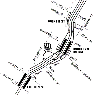
City Hall station consists of just one short platform on the loop taken by the local track just south of Brooklyn Bridge station. The 6 train runs around the loop to move from the downtown platform to the uptown platform without crossing the express tracks at grade. |
|
A construction photo shows almost all of the City Hall station, walls still untiled and track not yet laid. The self-supporting Guastavino ceiling tile and some decorative ceiling tile is in place. The three skylights throw sunshine onto parts of the platform. The arched opening leading up to the mezzanine and street is at the center of the platform. Board of Rapid Transit Railroad Commissioners. |
|
Three-quarters of a century later, the closed station looked much the same. Photo by David Sagarin, 1978. Collection of Library of Congress, Prints and Photographs Division, Historic American Engineering Record of the Heritage Conservation and Recreation Service, NY-122-49 . |
|
Up the short stairway from platform level is this view of the fare control area. From here, stairways in the arches at right and left once led up to the street. Photo by David Sagarin, 1978. Collection of Library of Congress, Prints and Photographs Division, Historic American Engineering Record of the Heritage Conservation and Recreation Service, NY-122-46 . For larger versions of the HAER photos, see Built in America at the Library of Congress's site. |
|
A diagram from the commemorative book The New York Subway / Its Construction and Equipment, published in 1904 by the subway's lessee, Interborough Rapid Transit Company, shows how close the station is to City Hall itself. The track passes literally below the front steps. From the midpoint of the curved platform, steps lead up under an arched opening to a small mezzanine area where fares were collected. From there, two stairways led up to each side of the street in front of City Hall. The loop track continues on a radius 147.25 foot curve and downward, so as to pass under the subway mainline in Park Row. The track rises back to main level on the far side of the main tracks to reach Brooklyn Bridge station back on the main level. The arrangement allows the local trains to terminate without crossing the path of the express trains. The loop avoided passing under the Post Office building that occupied the southern end of City Hall Park from 1875 to 1939. |
|
A photo of the City Hall kiosk on the north side of the drive (see the diagram above) is an excellent study of these structures that once covered all the IRT station entrances. City Hall itself is at right. The sign on the glass says UP TOWN under the larger ENTRANCE. Board of Rapid Transit Railroad Commissioners. From their Report. . . for the year ending December 31, 1903, New York: the Commission, 1904. |
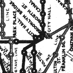
The official IRT map appeared to show City Hall at the end of a stub branch line, but because the station circle touches the main line, it may be that the designer was trying to show a loop. The hand-drawn and -lettered map is off scale and stylized, but this designer's license is not always used to provide clarity. Curves are all shown as angles, not the best choice to depict loops. The curve of the Seventh Ave express line from Park Place to Fulton St is very awkwardly shown, making an angle exactly where it crosses the Lexington and appearing to have some connection with City Hall loop. |
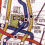
The far better designed Hagstrom subway map of 1936 showed very clearly that City Hall was on a loop. Doing so used up valuable space in a crowded area. Apparently the public were so familiar with the 'City Hall loop' that depicting it otherwise would be too contrary to expectations. (This image is fuzzy because it is an enlarged reproduction of a reproduction found in Twelve Historical New York City Street and Transit Maps, H & M Productions, 1997.) |
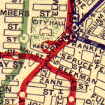
Street maps routinely showed the City Hall loop. A Rand McNally product designed circa 1920 shows it and the large cluster of transit lines at Brooklyn Bridge station just steps away. |
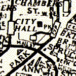
The map in Travelgide's How to Find Your Way in New York of 1928, shown much enlarged, is unusually accurate about the subway lines in this area, and even shows stations as rectangles rather than circles. Brooklyn Bridge station is shown extending just south of the turnoff to City Hall loop, which is what it did at the time (see the page on Brooklyn Bridge station). |
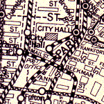
The Geographia map accompanying the Complete Street Guide to New York dates from sometime in the 1930's. The loop is drawn a little loosely. The Post Office and Mail St are named, but this edition from 1939 should be the last time, because they were both removed that year and the grounds were regained for City Hall Park. |
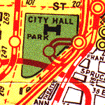
The Hagstrom street map of 1934 set a new standard for street maps of New York. The map is elegant both in the sense of conveying information and in an artistic sense. In this detail from a 1945 edition, the Post Office and Mail St are gone. |
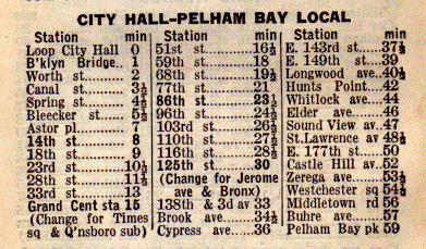
A sample Red Book guide, 1935, listed the City Hall station as one minute from Brooklyn Bridge. It also identifies it as Loop City Hall, showing how the loop was part of the public image of the station. |

|
|
|
|
|
|
|